Cutting into my morning reverie like a serrated knife, I heard the urgent voice of a reporter say “8.8 magnitude earthquake”…and then “tsunami warnings are being issued…” Any remnants of brain fog were blasted out of the grey matter as I focused on the voice. “I repeat. There has been an earthquake in Chile. The seventh strongest earthquake ever recorded…fatalities are being reported. The Pacific Tsunami Warning Center is issuing a tsunami warning for the greater Pacific Ocean…”
My heart began to race and images of the 2004 Indian Ocean Tsunami flashed across my memory. I turned up the radio and searched the internet for specifics. Then I noticed I had a voicemail. It was my parents calling, worried that we were in danger. Two time zones ahead of us, they’d heard the news before we’d even crawled out of bed. I tried to return their call, but couldn’t get through.
Finding information on the internet proved to be difficult. Then emails started coming through from concerned friends and neighbors who were out of the country. One pointed to the Weather Channel web site as a source of information. The radio was repeating the same report over and over and only discussed the Hawaii Islands in terms of who was at risk. The reporters even admitted they focused on Hawaii because it was a US state. I still hadn’t heard anthing about Mexico. “Damn xenophobic American News stations!!” The same was true of the Weather Channel web site. The lower half of the peninsula was completely cut off on the map they posted of the North American west coast illustrating areas at risk. I finally found the American National Oceanographic and Atmospheric Association’s Pacific Tsunami Warning Center web site: the warning level meter at the top of the page indicated that the severity of the tsunami was predicted to be HIGH.
My heart beat faster. I clicked on a link to the detailed written warning.
FOR
CHILE / PERU / ECUADOR / COLOMBIA / ANTARCTICA / PANAMA / COSTA RICA / NICARAGUA / PITCAIRN / HONDURAS / EL SALVADOR / GUATEMALA / FR. POLYNESIA / MEXICO / COOK ISLANDS / KIRIBATI / KERMADEC IS / NIUE / NEW ZEALAND / TONGA / AMERICAN SAMOA / SAMOA / JARVIS IS. / WALLIS-FUTUNA / TOKELAU / FIJI / AUSTRALIA / HAWAII / PALMYRA IS. / TUVALU / VANUATU / HOWLAND-BAKER / NEW CALEDONIA / JOHNSTON IS. / SOLOMON IS./ NAURU / MARSHALL IS./ MIDWAY IS. / KOSRAE / PAPUA NEW GUINEA/ POHNPEI / WAKE IS. / CHUUK/ RUSSIA / MARCUS IS. / INDONESIA / N.MARIANAS / GUAM / YAP/ BELAU / JAPAN / PHILIPPINES /TAIPEISEA LEVEL READINGS CONFIRM THAT A TSUNAMI HAS BEEN GENERATED
WHICH COULD CAUSE WIDESPREAD DAMAGE. AUTHORITIES SHOULD TAKE APPROPRIATE ACTION IN RESPONSE TO THIS THREAT. THIS CENTER WILL CONTINUE TO MONITOR SEA LEVEL DATA TO DETERMINE THE EXTENT AND SEVERITY OF THE THREAT.
And then among a long list of geographical locations and times that the tsunami could be expected, I found what I had been looking for, but hoped not to find –
My heart amped it up a notch. And then I thought “1749? Is that Zulu time? What?!” I mean, WHEN exactly is that?
It was 9:35 as I hurriedly looked up the conversion, but in my panicked state of mind I screwed up the calculation. Initially I thought it would be bearing down on us in minutes. “Shit!!” Then I redid the calculation and estimated a 12:49pm arrival. That gave us three hours to prepare. Immediately, I thought of all our friends and neighbors, the ranchers living on and near the beaches all around the peninsula. And there were several surfers and construction workers camped four miles down the road at Santa Elena on the beach. They probably didn’t have radios and I knew they didn’t have access to the internet. Did they know this was coming? Someone had to let them know.
My heart began to beat at a rate that I figured must be unsustainable and I started to feel a little light-headed. I quickly threw together a warning email including the text from the PTWC and sent it to everyone I knew living in the area. Then I started scurrying around the house like a mouse putting up stores for winter in the middle of a snowstorm. It was taking all my powers of concentration to keep my emotions in check and I wasn’t sure what I should be doing. After all, it was my very first tsunami warning. And all the while, in the back of my head, there was a battle raging on – a duel between two voices that said I needed to prepare for the worst, on the one hand, and a sense, call it intuition, that it was nothing and I needed to relax lest I have a heart attack.
Like the calm intuitive voice in the stormy space between my ears, Tony was unmoved, unfazed, completely unconcerned. And that just made me more frantic, feeling the need to move him into action. Now it was a duel of two against one, them against the voice that said it was better to be safe than sorry, better to take precautions than to be dead wrong. I tried these platitudes out on Tony. If they moved him, I couldn’t tell. I restrained myself from grabbing him by the shoulders and screaming in his face, “DON’T YOU CARE IF WE LIVE OR DIE?!! DO SOMETHING!!”
I decided I needed to do something productive and announced I was going to Santa Elena to warn the ranchers, workers and surfers. Trying hard to conceal his eyes as they rolled into the upper recesses of his skull, Tony handed me a radio as I jumped on the ATV. I finally felt like I had somewhere to put this energy that was overwhelming all my faculties with a sense of impending doom. A few hundred meters down the road it occurred to me to stop to check that I had enough gas to get there and back. Phew! The tank was full.
The first ranch I stopped at sits in an arroyo (dry river bed) right next to the sea, totally exposed. The women I spoke to probably thought I was out of my gourd. As I explained what could happen, they gradually came around. I left before confirming that they were able to convince their husbands that they needed to move to higher ground because some gringa loca said so.
Closer to Santa Elena, Fernando, the local surfing rancher, had heard something from the guys camping on the beach. I found them gathered on a rise by the roadside, all their belongings packed into their vehicles. They wanted to know if I thought they were safe on the small hillock they were standing on just above and about 50 meters from the sea. “They are telling people to get 100 feet above sea level,” I reported. When they pressed me if I thought that was necessary, I told them I was out of my league (I’m from Ontario, Canada for God’s sake!), but that I thought it was probably safer to be higher up. A couple of them nodded agreement, but they stayed right where they were.
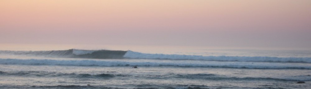
I continued south down the coast. Explaining the situation to Felix the foreman, I began to notice the sea level in the bay behind him drop. It was 10:45. In a matter of minutes, the bay emptied of water. Rocks and reefs were exposed that in eight years of surfing this spot I’d never seen before. It was like somewhere some godhead pulled a plug in the bottom of the Sea of Cortez, as though it were a gargantuan bathtub. And then, before I could mouth the word “tsunami,” it turned and started rushing back in. Like the tide in fast-forward. That really got my heart beating. The words:
flashed through my head. I told Felix and made haste to my next stop. Returning Northward up the coast, the surfers stopped me to ask if I’d seen it. They were excited and amazed, giddy. Again I repeated the warning about the possibility of the next wave being larger. But as we stood there it started again. We watched as the sea level dropped, and again, it turned and came back in, all in a matter of minutes. I’d seen enough and wanted to get home. I still wasn’t convinced that this was the least of what we would see that day.
Back at home by 12:30pm, unsure, amped up, I convinced Tony to humor me and we made plans to go up the hill to the guest house to have lunch. All our preparations made, I was about to head up the hill when the voice on the radio reported “the threat is past for the area around Cabo San Lucas where open ocean buoys registered a tsunami wave of 1.1 foot.”
Only 1.1 foot??? I pondered the reality that a tiny wave generated by a powerful earthquake off of Chile had produced the dramatic changes in sea level we’d all witnessed that morning. While it may not have been life threatening, it was nevertheless a dramatic display of the power of nature to change the course of our lives. I considered how things might have been different had conditions and circumstances been altered.
The difference in magnitude of the Indian Ocean earthquake and this one were not all that great. According to Wikipedia, seismologists estimate that the earthquake was so powerful that it shortened the length of the day by 1.26 microseconds and moved the earth’s axis of rotation by 3 inches. Had the earthquake occurred in shallower water or had the tremor been sustained longer, the power of the tsunami generated would have been substantially greater.
At 2pm, as I felt the adrenalin begin to wear off, a massage therapist arrived for the appointment I’d scheduled earlier in the week and had forgotten in the midst of the morning’s melee. I lay down on her table and did my best to relax. As she began working out one of several knots that had taken up residence in my shoulder, oblivious, she pronounced, “you’re unusually tense today.”
For detailed information on the 2010 Chile Earthquake and its Tsunami CLICK HERE.
